|
This
assignment is intended to provide a sense of the physical setting
over which the history of South Asia has unfolded. It will give
an appreciation of the topography, distances, cities, states, and
political boundaries of the British raj, the princely states of
India, and the nations of present-day South Asia. In this exercise,
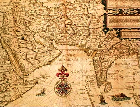
students are encouraged to use J. Schwartzberg (ed), A Historical
Atlas of South Asia and Gordon Johnson (ed), A Cultural Atlas
of India as well as other atlases and reference works.
You are not obligated to complete this assignment on your own. You
may collaborate with each other in preparing your maps (but beware
of shared errors). Do not be concerned about the various spellings
of Indian names; after all, they were not originally written in the Roman script.
All items must be clearly labeled on the maps in block letters (not
number-keyed to a list in the margin) so that future reference is
easy for you and grading is easy for the instructor. Grades will be based primarily
on accuracy and neatness, but artistic flourish and creativity will
also be considered.
The blank maps supplied in class are the ones that must be used.
Do not submit computer-generated designs. Please staple the two
maps together and be sure to put your name on every page.
Maps are due at the beginning of class on Wednesday, February 1.
MAP I
Using a pastel color, shade all areas above 1500 ft (not meters).
Arabian Sea
Deccan
Hindu Kush Mts.
Karakoram Range
| Aravalli Range
Gomal Pass
Khyber Pass
Western Ghats
| Bay of Bengal
Bolan Pass
Thar Desert
Vindhya Range
| Himalaya Mts. (show Mt. Everest)
Kanya Kumari (Cape Comorin)
Gangetic Plain
|
Brahmaputra
Gandak
Hugli/Hoogly
Mahandi
Son
| Chambal
Ganges/Ganga
Indus
Gogra/Ghaghara
Sutlej
| Chenab
Godavari
Ravi
Penner
| Kaveri/Cauvery
Narmada/Narbada
Krishna/Kistna
Yamuna/Jamuna/Jumna
|
MAP II
Agra
Amritsar
Bijapur
Chittor/Chittorgarh
Ellora
Ghazni
Hyderabad
Kabul
Leh
Panipat
Pune/Poona
Surat
|
Ajanta
Arcot
Bodh Gaya
Cochin/Kochi
Fatehpur Sikri
Ghor
Jaipur
Kanauj
Lucknow
Pataliputra (Patna)
Pondicherry
Talikota
|
Ajmer
Ayodhya
Bombay/Mumbai
Delhi
Fort St. George (Madras)
Goa
Jaunpur
Khajuraho
Madurai
Peshawar
Seringapatam
Taxila
|
Allahabad/Prayag
Benares/Varanasi/Kashi
Calicut
Deogiri/Daulatabad
Fort William (Calcutta)
Harappa
Kurukshetra
Lahore
Mohenjo Daro
Plassey/Pulasi
Srinagar
Vishakhapatnam
|
Afghanistan
Bactria
Carnatic
Gandhara
Ladakh
Multan
Punjab
Tibet
|
Andhra
Bengal
Ceylon
Golconda
Magadha
Mysore
Rajasthan
Vijayanagar
|
Assam
Bihar
Coromandel Coast
Gujarat
Malabar Coast
Orissa/Odisha
Sind
|
Awadh
Bijapur
Konkan Coast
Kashmir
Malwa
Persia
Tamil Nadu
|
Note: You do not need to draw
the borders of the regions on Map II (they changed frequently during the period we are studying).
Instead, write the name of the region in the appropriate area of the Indian subcontinent.
Finally, on MAP II, lightly shade the areas of the Mughal Empire green, the Maratha lands yellow, and
the Sikh states red, circa 1700. (Clue: Maratha power had not yet expanded beyond the Western Ghats).
|