|
This
assignment is intended to provide a sense of the physical setting
over which the history of South Asia has unfolded. It will give
an appreciation of the topography, distances, cities, states, and
political boundaries of the British raj, the princely states of
India, and the nations of present-day South Asia. In this exercise,
students are encouraged to use J. Schwartzberg (ed), A Historical
Atlas of South Asia and Gordon Johnson (ed), A Cultural Atlas
of India as well as other atlases and reference works.
You are not obligated to complete this assignment on your own. You
may collaborate with each other in preparing your maps (but beware
of shared errors). Do not be concerned about the various spellings
of Indian names; after all, they were not originally written in the Roman script.
All items must be clearly labeled on the maps in block letters (not
number-keyed to a list in the margin) so that future reference is
easy for you and grading is easy for the instructor. Grades will be based primarily
on accuracy and neatness, but artistic flourish and creativity will
also be considered.
The blank maps supplied in class are the ones that must be used.
Do not submit computer-generated designs. Please staple the three
maps together and be sure to put your name on every page.
Maps are due at the beginning of class on Monday, January 31.
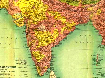
MAP I
Using a pastel color, shade all areas above 1500 ft (not meters).
Arabian Sea
Deccan
Hindu Kush Mts.
Karakoram Range
| Aravalli Range
Gomal Pass
Khyber Pass
Western Ghats
| Bay of Bengal
Bolan Pass
Thar Desert
Vindhya Range
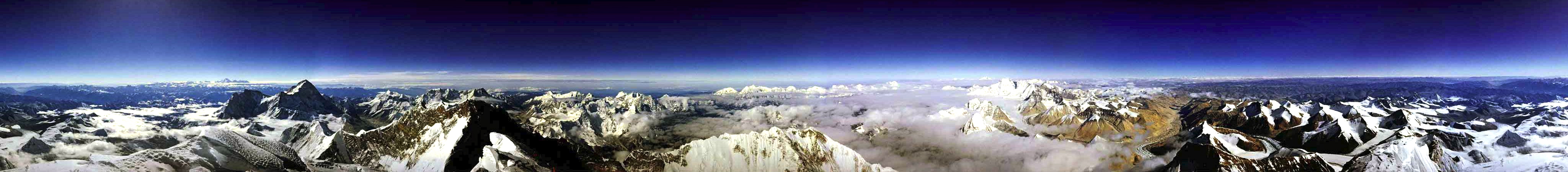
| Himalaya Mts. (show Mt. Everest)
Kanya Kumari (Cape Comorin)
Rann of Kutch
|
Brahmaputra
Gandak
Hugli/Hoogly
Mahandi
Son
| Chambal
Ganges/Ganga
Indus
Gogra/Ghaghara
Sutlej
| Chenab
Godavari
Jhelum
Penner
Ravi
| Kaveri/Cauvery
Narmada/Narbada
Krishna/Kistna
Irrawaddy
Yamuna/Jamuna/Jumna
|
MAP II
Agra
Amritsar
Benares/Varanasi
Chandigarh
Dhaka/Dacca
Hyderabad
Jaipur
Kabul
Kargil
Lhasa
Murshidabad
Peshawar
Pondicherry
Sikkim
|
Ahmedabad
Ayodhya
Bhopal
Chittor/Chittorgarh
Delhi
Imphal
Jammu
Kandahar
Kathmandu
Lucknow
Nagpur
Plassey/Pulasi
Port Blair
Simla
|
Aligarh
Bangalore/Bengaluru
Bombay/Mumbai
Cochin/Kochi
Goa
Islamabad
Jhansi
Kanpur/Cawnpore
Kohima
Madras/Chennai
Naxalbari
Pokhran/Pokaran
Rangoon/Yangon
Srinagar
|
Allahabad
Baroda/Vadodara
Calcutta (Ft. William)
Colombo
Gorakhpur
Jaffna
Jodhpur
Karachi
Lahore
Meerut
Patna
Pune/Poona
Seringapatam
Surat
|
Andaman Islands
Bengal
Gujarat
Madhya Pradesh
Orissa/Odisha
Tamil Nadu
|
Assam
Bihar
Jhansi
Maharashtra
Punjab
Telangana
|
Awadh/Oudh
Ceylon
Kashmir
Malabar Coast
Rajasthan
Tibet
|
Baluchistan
Coromandel Coast
Kerala
Mysore
Sind
Uttar Pradesh
|
* Note: You do not need to draw the borders of the regions on Map II
(they changed frequently during the period we are studying). Instead, write the name of
the region in the appropriate area of the Indian subcontinent.
MAP III
Using solid lines, draw the borders of the following present-day nations:
Afghanistan
India *
Myanmar (Burma) | Bangladesh
Maldives
Sri Lanka | Bhutan
Nepal
| China *
Pakistan *
|
* Use dotted lines to show all borders disputed by India, Pakistan, and China.
|